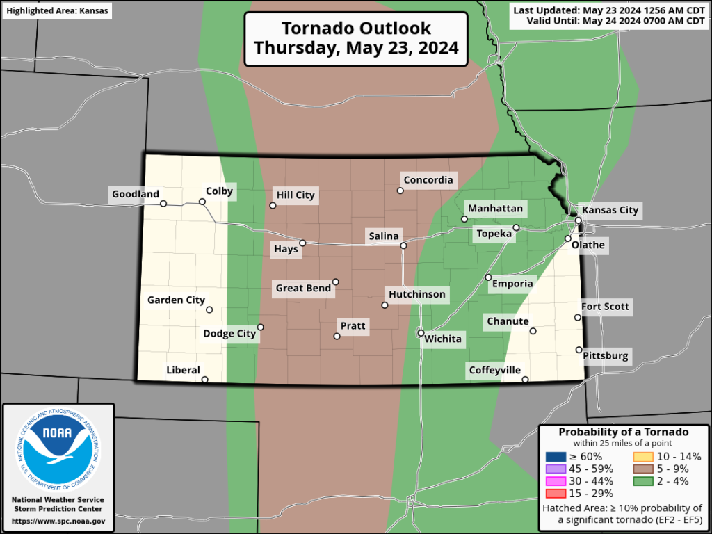
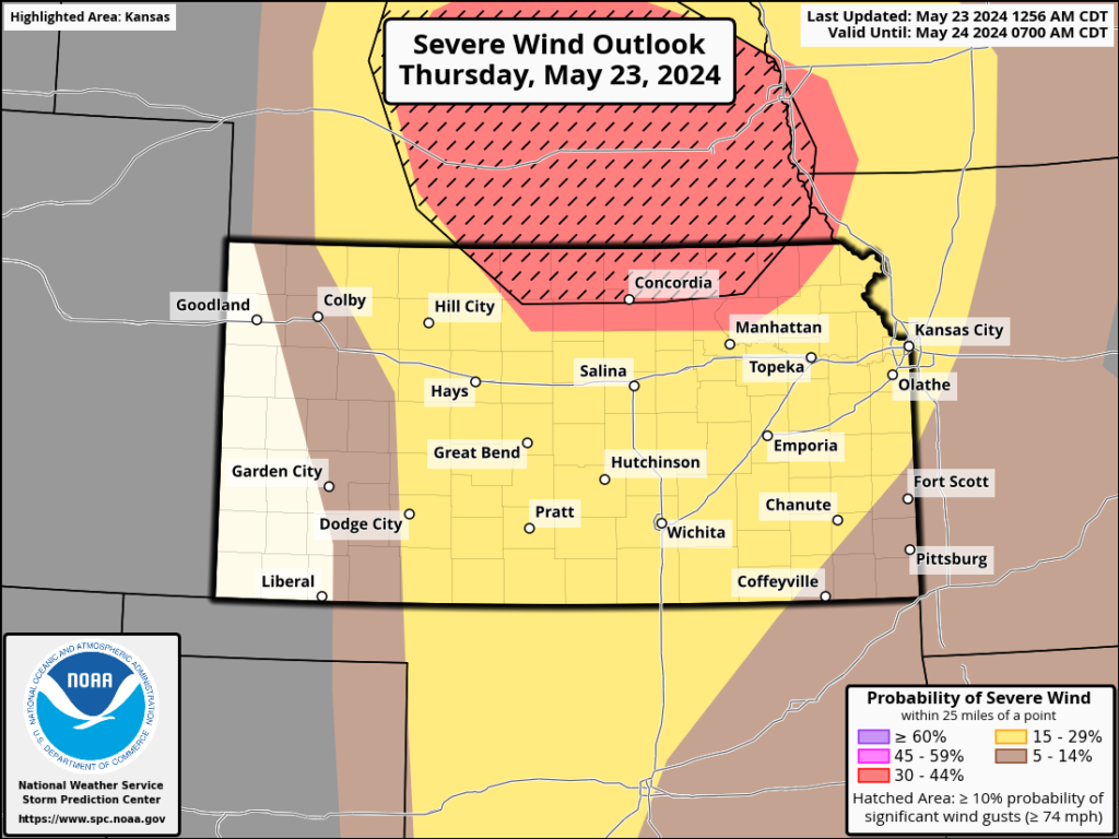
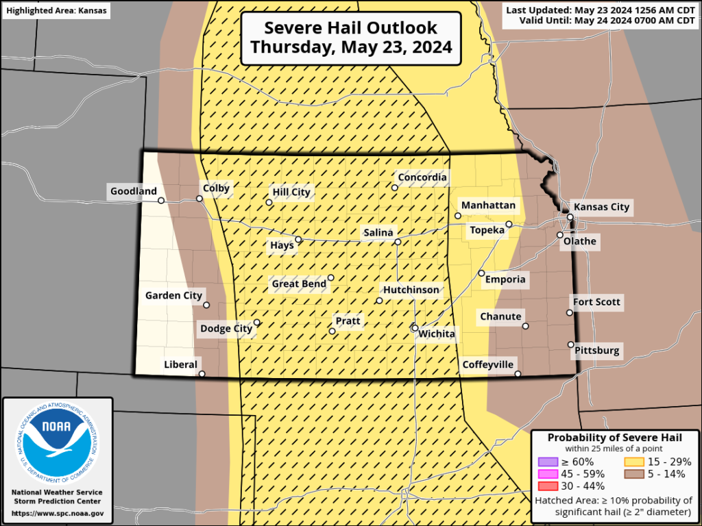
The focus for severe weather today will be far northern Kansas and Nebraska. But a large swath of the country is covered by a slight risk for severe storms. Isolated to widely-scattered storms are possible with all severe weather risks on the table. Tornado risk would be generally in the evening. By far more of us will stay dry today than will receive storms.
SPC Risk areas, Probabilities


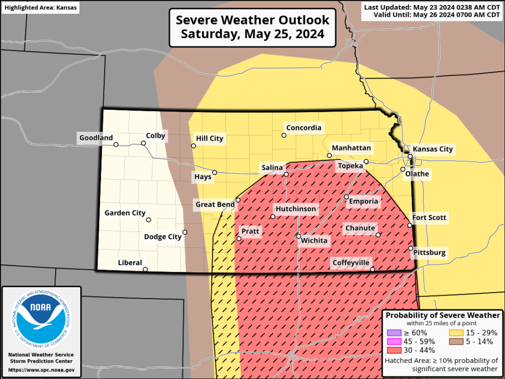
Looking ahead to Saturday, there is the potential for another high-end day, but the timing of the best moisture return is a bit questionable and could keep the main storm risk south of the state line. Nonetheless, the middle 2/3 of the state south of I-70 is in an enhanced severe storm risk area.
SPC Outlook Graphics for Saturday


Looking ahead, the expected pattern change will not setup completely, with dry northwest flow conditions only in place a couple of days before another chance for storms appears mid- to late-week.
