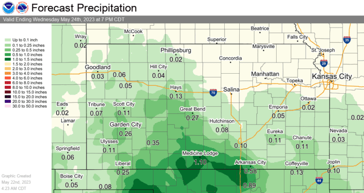
A dry line is expected to setup this afternoon, with some models showing it along the Turnpike while others push it east into the Flint Hills. Any shower or storm activity would be east of the dry line. The northeast corner of Kansas is in a SLIGHT (level 2 of 5) risk for severe weather, with the Kansas City metro and northern Missouri having a bit higher severe chances.
Southwesterly low level flow will bring much warmer temperatures into the area today and tomorrow. A slow-moving low will come northeast out of Mexico over the weekend and provide rain chances starting tomorrow night, with Mothers Day likely to be more rain than sunshine.

After Monday, forecast trends are all over the place but it appears we’ll be mostly dry through the week.


