A potentially active day across Kansas and Oklahoma, but there are some potential bust factors.
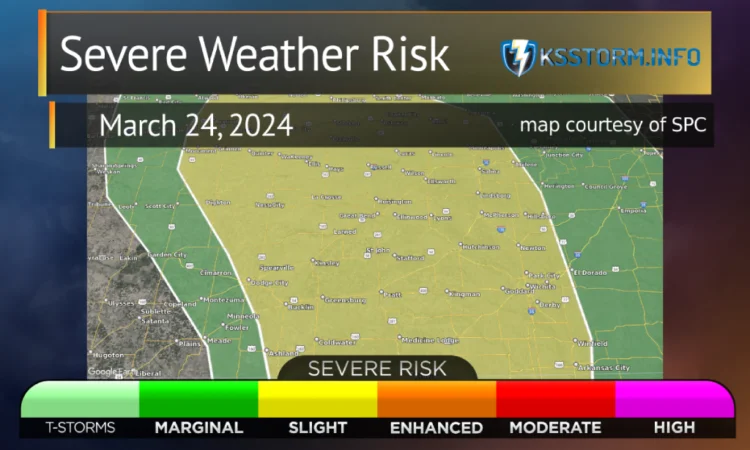
SPC Outlook

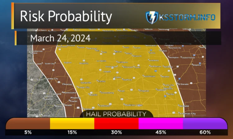
A cap should inhibit thunderstorm development through early Sunday afternoon. But increasing ascent associated with the upper trough, along with rapidly cooling mid-level temperatures and gradually increasing low-level moisture, should act in tandem both to erode the cap and support around 500-1250 J/kg of MLCAPE by late afternoon. This narrow warm sector should be located along and very close to the surface dryline, which is forecast to mix eastward into parts of western KS/OK by peak afternoon heating. Convective initiation should occur by late afternoon across these areas with 35-50 kt of deep-layer shear present. This will be sufficient to support supercells with mainly a large hail threat initially as steep mid-level lapse rates aid updraft accelerations.
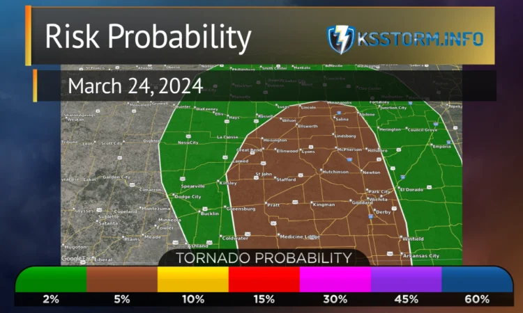
By early Sunday evening, a southerly low-level jet is expected to strengthen further to around 45-60 kt over portions of central KS/OK. A narrow spatial and temporal window may exist around 23-03Z Sunday evening across this area where ongoing supercells may encounter somewhat greater low-level moisture (low to perhaps mid 50s surface dewpoints). During this same window, effective SRH will also rapidly increase in tandem with the low-level jet. The threat for a few tornadoes may exist with any persistent supercells given the strong low-level shear, but the modest low-level moisture could still be a somewhat limiting factor. Convection should tend to become elevated Sunday night as it spreads eastward into eastern KS/OK and vicinity. But, some potential for hail and strong/gusty winds may continue as thunderstorms attempt to grow upscale into small bowing line segments.
SPC Day 2 Outlook issued early morning 2024-03-23
Risk Probabilities


My Call for the Day
I see storms starting possibly as far west as Cimarron, but more likely between US-283 (WaKeeney to Dodge City to western Clark County) and US 183 (Hays to Kinsley to Coldwater), and I like the area along and south of US-50 best. If we can get out of town early enough, initial staging point would probably be Greensburg. That puts us within 30 minutes’ drive of initiation if my area is correct.

I think the best chance for tornadoes will be right on the dry line, maybe up into the triple point. We’ll be watching the triple point closely, it needs to stay south of K96, I believe, or there just won’t be enough moisture to set the stage. Moisture my top concern for tomorrow, we’ll be watching short-term and mesoscale models closely, along with current conditions, for a small area of dewpoint pooling just ahead of the dryline.
As the storms move east of US183 and especially US281 (Russell to Medicine Lodge) they will line out and then the risk transitions to wind and some hail. Actually, wind will be a factor all day long, as it will be howling above 50mph gusts most of the day, and the same from the north behind the front tomorrow night. There is the potential for non-thunderstorm wind damage tomorrow.
I think as the storms pass through the K-14 and I-135 corridors, they will start to weaken and dissipate. I expect fewer warnings east of I-135 than west. And I believe the line clears I-135 around or before 11pm. General storm motions along the line will be north-northeasterly at around 35mph.
Safety Reminder
With a risk of tornadoes tomorrow, I want to offer this reminder:
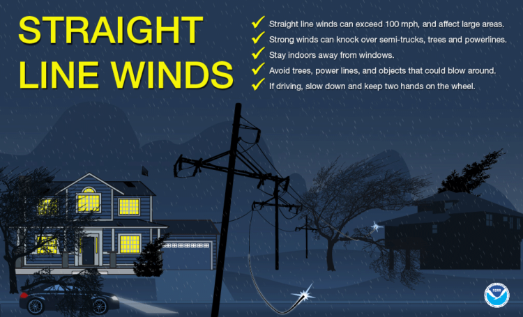
I believe the higher risk for property damage tomorrow is straight line wind. Here are a few tips:

